Playa Del Rey to Manhattan Beach - 11.46 mi RunKeeper

Sunday, August 21, 2011
This weekend's Bike rides - Aug 20-21
What an awesome weekend, on Saturday we biked 10.5 miles from Santa Monica to Venice Beach. We rode the bike path along the beach which passes through Santa Monica and the crazies on the Venice Board Walk. Sunday we parked at Playa del Rey Beach and road the bike path all the way down to Manhattan Beach......11.5 miles. I do not have any pics but I do have a cool video my wife made of the 2 rides.....enjoy.
I'm also posting the 2 rides on my blog in just a few minutes.
Beach ride - Santa Monica to Manhattan Beach
I'm also posting the 2 rides on my blog in just a few minutes.
Beach ride - Santa Monica to Manhattan Beach
Friday, August 19, 2011
Today's Hike - Eaton Canyon, Altadena, CA
Eaton Canyon is an awesome hike in Altadena, CA. From the 210, exit Altadena dr and head north to Eaton Canyon entrance. Tail head is at the end of the parking lot. From the trail head, head North through the canyon on the main trail. The main trail follows the the river/creek all the way to the canyon's end where you are greeted with huge water fall. Out and back it's just over 3 miles but there is other side trails you can take to add a little more mileage. Here are some links to there website.
http://www.ecnca.org/hiking_trails/hiking_trails.html
http://www.ecnca.org/hiking_trails/EC_Trail_Map.pdf


http://www.ecnca.org/hiking_trails/hiking_trails.html
http://www.ecnca.org/hiking_trails/EC_Trail_Map.pdf

Various trail pics


Water Fall

More trail pics


Tuesday, August 16, 2011
Today's Hike - Mt. Tom - Glendale, CA
Today's hike took me to Mt. Tom near my apartment in Glendale, CA. This trail goes by many names, Mt. Tom, Las Flores Motorway or the "Sunshine Trail". There were sweeping views of downtown Glendale, Griffith Park, Burbank, Cherry Canyon & downtown LA.


(Above - This sign greats you as you start the trail)
(Below - Downtown Glendale & smoggy Downtown LA in the background)

(Below - Mt. Bikers)


Scenic Pics from Mt. Tom trail


Sunday, August 14, 2011
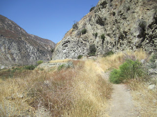
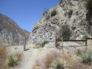
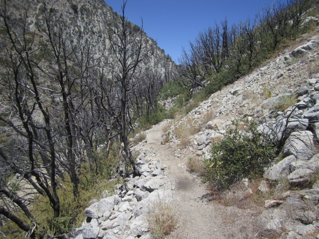
Today's Hike - Stone Canyon (Near Tujunga, CA), Angeles National Forest 8/14/11
Well, I looked up my next hiking adventure in my trusty guide book and decided to try Stone Canyon off of Big Tujunga Canyon Rd. Unfortunatley, due to the station fire of 2009, this trail along with a couple others were closed. However, I was able to squeeze in almost 2 miles anyways. Since this trail has hardly been used for over 2 years it was overgrown in a lot of areas. Enjoy the pics :)


Saturday, August 13, 2011
Today's Hike - Mt. Lowe, Angeles National Forest 8/13/11
So I got to the trail about 1:00 pm. There were signs up that stated the trail was closed due to "rock slides" and erosion. However, I saw a couple hikers and a few mt bikers and they all said they ignore the signs and do the trail anyways. Mt Lowe is a sweet trail, I highly recommend it. It's 3.2 miles of mostly single track (out & back).
Location: Angeles National Forest, Mt. Wilson road (exactly 2.4 miles from the intersection of Angeles Crest Hwy & Mt. Wilson rd)
Trail Milestones:
0.0 - Start at unmarked Eaton Saddle trail head off of Mt. Wilson rd (Mt. Lowe fire road)
0.3 - Pass thru tunnel
0.5 - Turn left onto Mt. Lowe Trail
1.3 - Turn right on Mt. Lowe West Trail
1.5 - Turn left on spur trail to summit
1.6 - Reach the summit


Subscribe to:
Posts (Atom)